
The map Of Our Long Weekend Ontario Road Trip. It is not our exact route, but yes, it was 1000+ kilometers!
WARNING: THIS IS A LONG POST WITH TONS OF SNAPPIES!
Sometime last month, my girlfriend mentioned to me that her sister and brother were both heading to a campsite in eastern Ontario for this Civic Holiday Weekend. My girlfriend isn’t the camping type, but still wanted to meet up with the families after spending a night in the comfort of a nearby hotel. She also mentioned that she wanted to see an attraction in the Muskoka region. As you could see in the map above, Muskoka and the campsite are very far apart, but if you know me, I LOVE ROADTRIPS! So, I mapped a route and when the weekend came, we jumped into Tricia to begin our adventure!

The dam and waterfall at Burk’s Falls, Ontario
We left Toronto early…using the (nearly empty for today) Don Valley “parking lot”, the 401 and then the 400 towards cottage country at around 7:30 AM (and beating the Saturday “rush”) to finally join with Highway 11 in Barrie. Around 10:30 AM, we made it to our first stop – Burk’s Falls. One of the draws in the town is a man-made waterfall, from a timber and concrete dam. A small hydro-electric turbine station was housed nearby. There also was a small welcome and information building that serves ice cream for visitors.

“Don’t mind the Screaming Head…” Screaming Heads, Burk’s Falls, ON (Nikon D300, AF-S DX NIKKOR 35mm f/1.8G @ f/8, 1/250, ISO100)
We continued driving onward from the dam for another 15 minutes along a mix of paved and gravel roads to finally arrive at Screaming Heads. As you can see from the picture above, the entire property is a whole 50 acres full of (you guessed it) screaming heads! We didn’t enter too far into the private property. We didn’t know if the place was open or closed, and we couldn’t find the donation box (even though we were informed there was one.) From what we could gather, aside from being an art exhibit, the property is also a working farm.

“Speak no evil…” Screaming Heads, Burk’s Falls, Ontario
Screaming Heads is a very scenic property – plenty of rolling hills, with lots of these concrete “screaming heads” popping out of the ground.

“Caterpillar Sunbathing” Screaming Heads, Burk’s Falls, ON (Nikon D300, AF-S DX 35mm NIKKOR f/1.8G @ f22, 1/50, ISO 100)
We wrapped up our exploration early and looped back into Burk’s Falls to make a quick pit stop at a local bakery for coffee and snacks, then continued on our journey east.

“We’re coming for you” Screaming Heads, Burk’s Falls, ON (Nikon D300, AF-S 35mm DX NIKKOR f/1.8G @ f22, 1/13, ISO 100)
Heading this far north, the only routes to the eastern reaches of Ontario would be to go through or around Algonquin Park. I wanted to visit Oxtongue River and Ragged Falls Provincial Park before cutting through Algonquin using Highway 60, but I turned off the path way too early. By some stroke of luck I found some rapids along the Oxtongue River instead.

Oxtongue River (Nikon D300, AF-S 35mm DX NIKKOR f/1.8G @ f16, 1/125, ISO 200)
The dirt road I used to find this area was on my GPS and on Google Maps, but the park where we landed definitely was not! I think it is better left a secret – this scenery is best for those who are willing to explore and get off the beaten path. I’ll leave this place for you to discover!

Oxtongue River
I would guess during the spring run-off or after a good rainfall that getting into this place would not be as safe, but I also would imagine that the scenery of heavy amounts of water rushing through these rocks would be something to capture on camera.
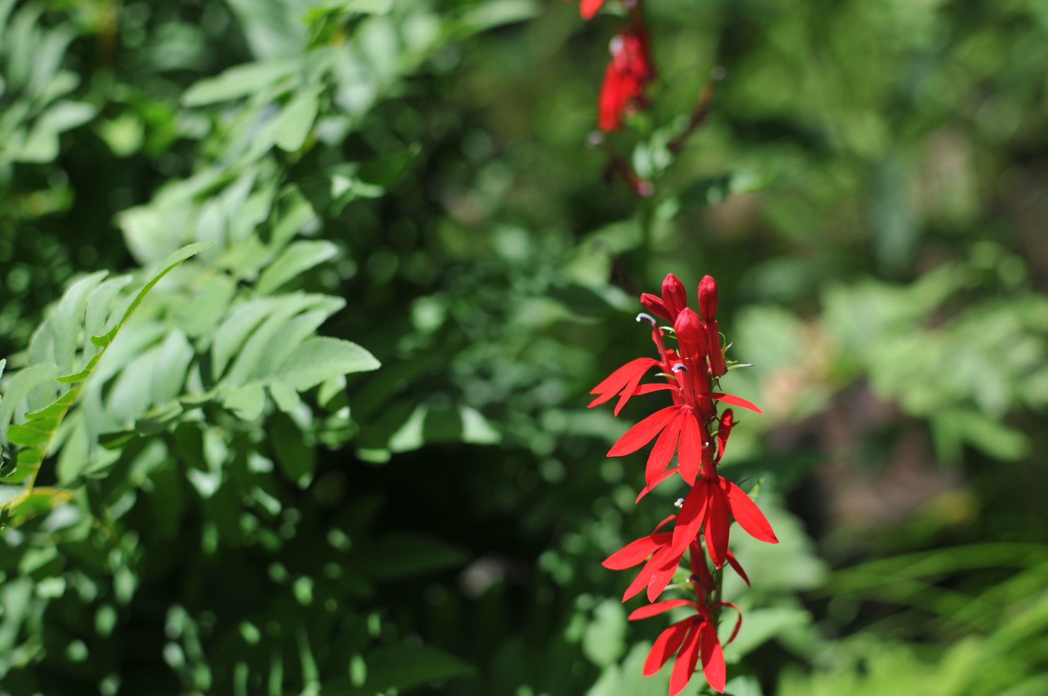
Flowers by the Oxtongue River (Nikon D300, AF-S 35mm DX NIKKOR f/1.8 @ f/2.8, 1/1250, ISO 100)
My girlfriend decided to bathe in the sun for a little bit and watched me as I hopped left and right about the countless rocks looking for photos to take.

“Growth in the harsh rocks and water…” Oxtongue River (Nikon D300, AF-S 35mm DX NIKKOR f/1.8 @ f/4, 1/640, ISO 200)
After baking for about a half hour (more like burning…I had no sunblock) I decided to call it quits and retreated to the forested road where Tricia was parked and we continued to head into and through Algonquin.

Tricia…my Jeep parked at the Algonquin Park Visitor Centre. Haze in the shot mostly due to me not cleaning the lens.
It takes a little more than an hour to drive through the park and it was already well past noon. My girlfriend and I couldn’t decide where to eat lunch, so we stopped at one of the visitor centres for our bite. Parking permit/day pass, hamburger…soup…hot dog… they were pricey and ho-hum, but at least we did our part to support the park by buying from their restaurant. I know there is plenty more things to see and do at Algonquin, and although we have a day pass, discovering what else the park had to offer would be for another time…

Algonquin Park from the deck of the visitor centre.
We trekked onward and crossed the eastern border of Algonquin. Tricia’s GPS knew we were on Highway 60…but zoomed out to show that we were out in no man’s land. Our approximate arrival at the hotel pegged at about 5:30 pm, so I rolled the windows down and opened up the sunroof. The 22C air rushing through the cabin of the car was so refreshing! To many people who live around the Greater Toronto Area, the areas between Algonquin and Ottawa are unknown, so I wasn’t expecting to see much between the park and our hotel. All of a sudden, we came by this church!

Angels holding the holy water by the main aisle of St. Mary Catholic Church, Wilno, ON
A Google search of St. Mary of Czestochowa Church, will pull up results from Chicago, IL and London, ON. You have to search for “St. Mary Catholic Churct Wilno, Ontario” (Churct wasn’t a misspell) to find this place.
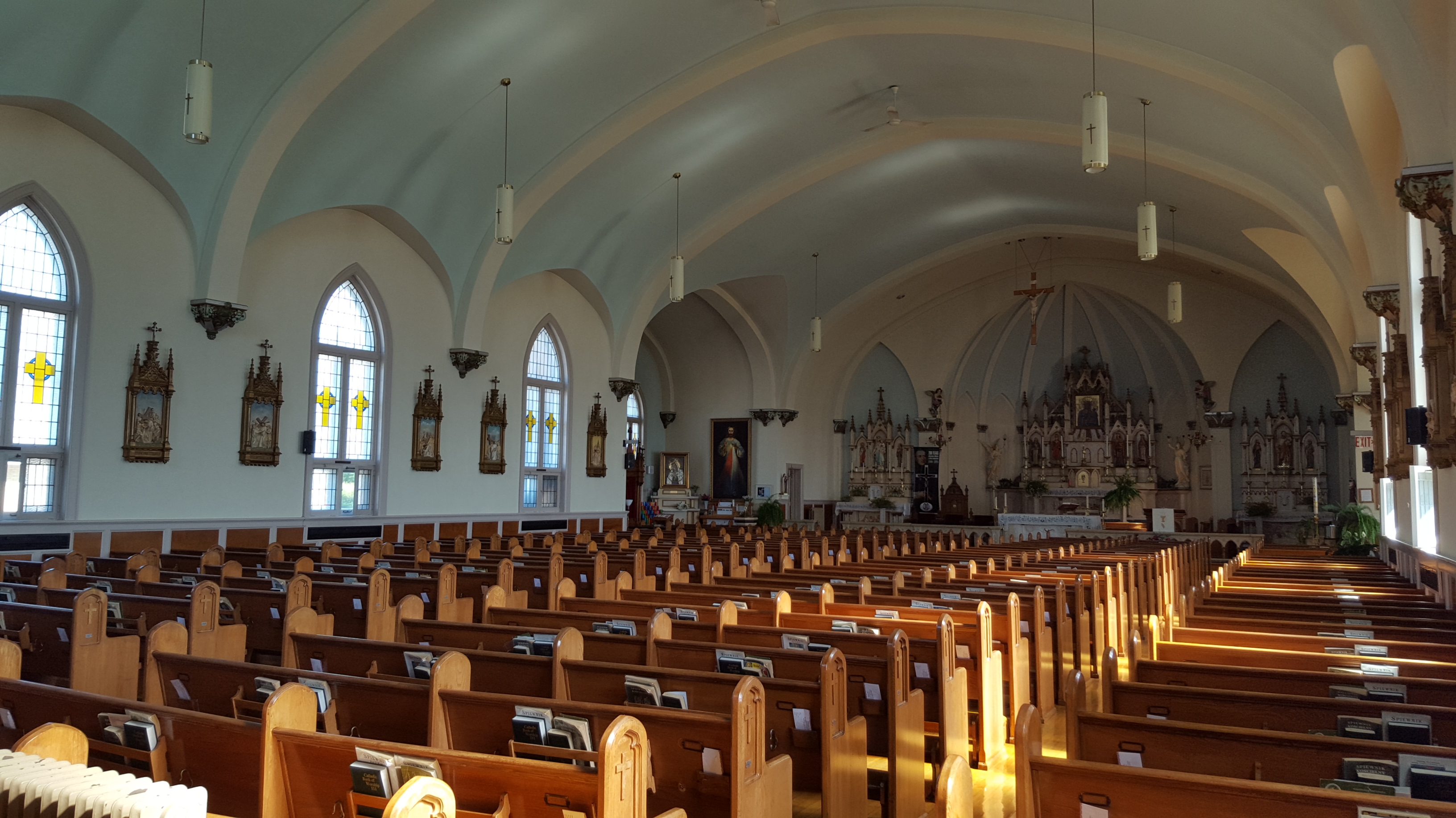
The beautiful interior of St. Mary of Czetochowa Church, Wilno, ON
This church is the first Polish parish in Canada and was established in 1875 (Wilno is also the first polish settlement in Canada, being established around 1858.) The church itself was built in 1937. The wooden floors in the church were so shiny, I was scared to walk in. The sanctuary was very simple, looking but at the same time, ornate and detailed.

The Sanctuary of St. Mary of Czestochowa Church, Wilno, ON
After a moment of prayer and reflection, my girlfriend and I hopped back into Tricia and rolled off, now expecting a few more delightful surprises on our way to the hotel. We soon found one in a small community called Eganville.

Eastern view from the Centennial Park Footbridge in Eganville, ON
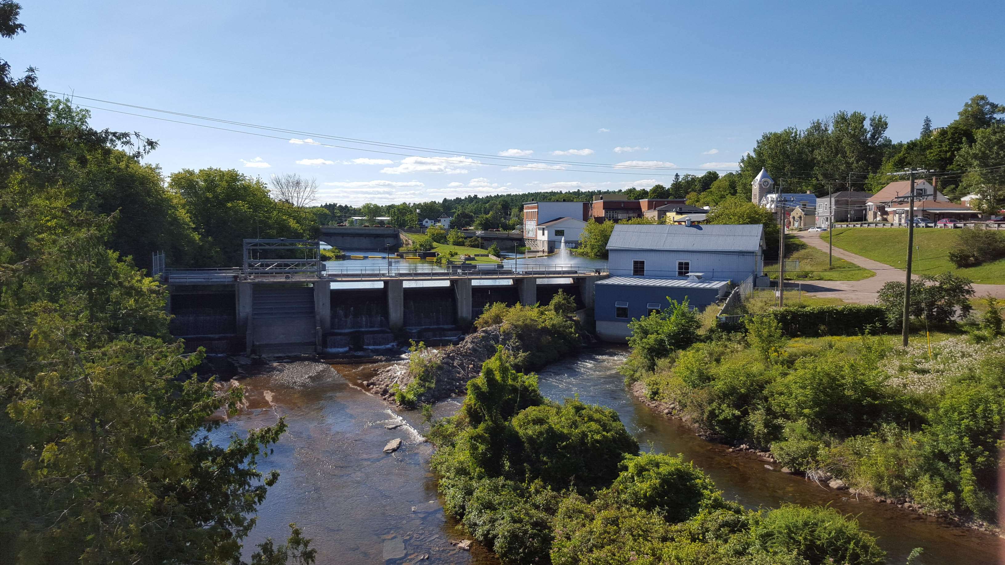
We stepped onto a steel footbridge that spanned a limestone valley created by the Bonnechere River, below. The Bonnechere River is a tributary to the Ottawa River. It starts in Algonquin Park and divides this town into north and south, the dam in the picture below generates electricity for the town.
West view from the Centennial Park Footbridge, Eganville, ON
The footbridge we stood on was quite solid, but because it was higher than the suspension bridge at Ranney Gorge (and I am scared of heights) my legs were wobbly during my first couple steps. Getting over the bridge in hopes of finding a way down to the river, we walked by a stone fence. Worth a snappy, since we couldn’t find a way into the river without getting wet.

Stone fence in Centennial Park, Eganville, ON (Nikon D300, AF-S 35mm DX NIKKOR f/1.8 @ f/18, 1/160, ISO 100)
As you can tell by the shadows in the pics, it was getting later in the day. A quick look at the time told us it was already 5:00! Smiths Falls in 1/2 hour? Negative! But we decided enough with the stopovers. Let’s get to Smiths Falls for dinner! We rushed down what was left of Highway 60 to join with the 417 in Arnprior, then quickly looped back westward along Highway 7, just outside Stittsville.
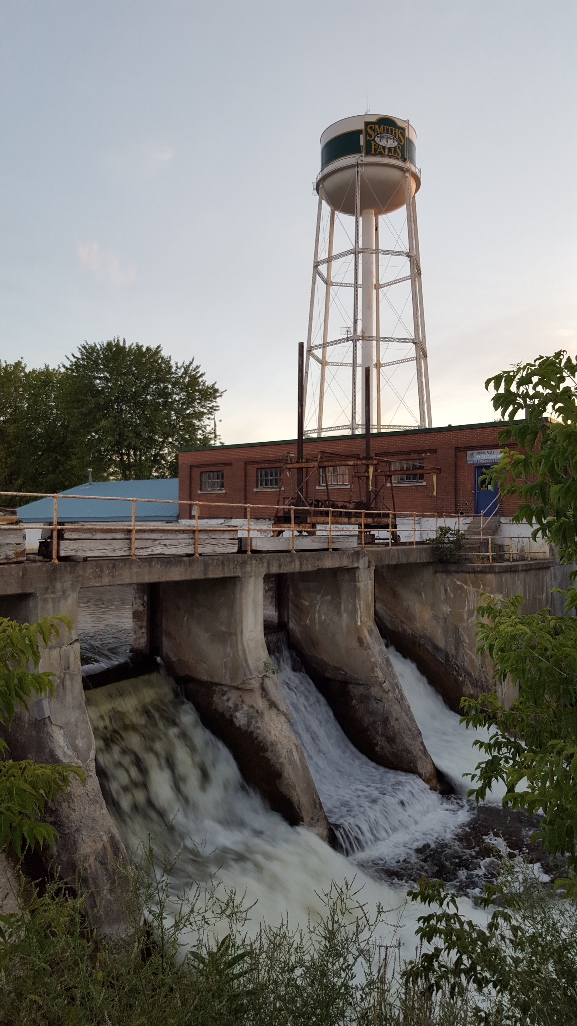
The Water Tower overlooking the Dam at Smiths Falls, ON
“A little less than a half hour to go…” according to Tricia’s GPS as we rolled into Carleton Place and found Highway 15. We motored onward and finally checked into our hotel at about 7:30 PM. A bit late, but still enough time to walk a bit around town to grab a bite in their downtown area. This was followed by walk around the park surrounding the Rideau Canal lock found inside the town.

Another dam at Smiths Falls, ON
Slightly overcast skies made for spectacular sunset, which we had just missed, but the twilight colours were surreal!

“Enjoy the Sunset in a Boat!” Rideau Canal, Smiths Falls, ON
We were even surprised with the view of our hotel from the canal.

The Econo Lodge Hotel, Smiths Falls, ON
That was it for the day. I needed some rest. We hunkered down in the hotel for the night in preparation for the second day of our Ontario road trip. Morning came with my girlfriend and I grabbing a quick bite from the hotel for breakfast before checking out. Our next destination: Charleston Lake Provincial Park.

“CORN! FINALLY IN SEASON!” A selfie with my god daughter and my girlfriend at Charleston Lake
Yes, my youngest god daughter is growing up quicker than I can believe, and is more fun to play with each time we meet. After our meet up, my girlfriend and I start a hike.
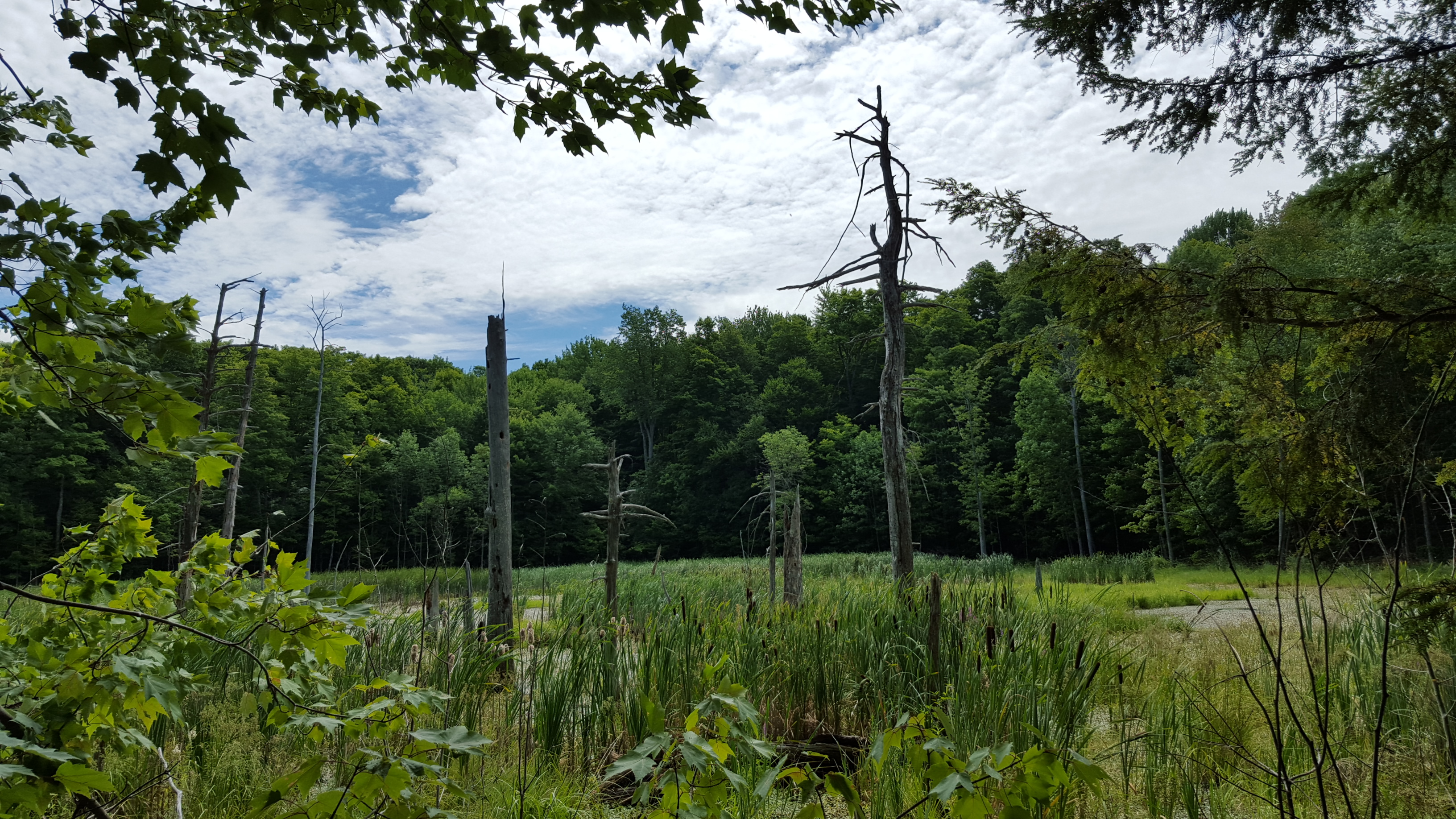
“The bog full of turtles I can hear, but not see…”
The trail we hiked had plenty to offer. Lots of maples and pines, wildlife, a huge bog full of turtles, moss, rugged terrain, rock faces and low lying plant life, like ferns and your dreaded poison ivy (which to this day, I still can’t tell what it looks like!)

There are cliffs, if you venture a bit off the trail. Not a place where you should be careless.

Lots of opportunities for selfie moments too… HAHA!

As I mentioned earlier, wildlife was plentiful. Nikki’s “beer can” (70-300mm/4.5-5.6) was performing ok for these next 3 shots.

(Nikon D300, AF Zoom 70-300 f/4-5.6G @ 300mm, f/8, 1/250, ISO 200)
A lot of my cousins (chipmunks…what’s my name? haha!) were there, and they weren’t that shy, but definitely quicker than my shutter. The shot below was probably one of 3 successful shots out of many countless attempts. Nikki’s “beer can” at close to 300 mm, combined with the distance of the chipmunk and the dark shade provided by the canopy of trees above were not very forgiving to even my pretty steady hands – I definitely need to pull out this lens more and practice more “sniping”.

(Nikon D300, AF Zoom 70-300 f/4-5.6G @ 270mm, f/5.6, 1/30, ISO 1250)
My girlfriend’s brother-in-law even spotted a woodpecker! “Pew-pew!” 10 shots later…

(Nikon D300, AF Zoom 70-300 f/4-5.6G @ 300mm, f/8, 1/125, ISO 800)
Our fun on the trail was done. So we needed to relax again. Thankfully, the campsite was not in a radio-free zone and the Toronto Blue Jays were playing against the Baltimore Orioles to stay in first place. Tricia’s radio really came in handy here, allowing us to listen in on the action. Only outdoorsy people would understand why Jeep made their radio this way. Pop the hatch and swing down the speakers – better sound than a portable radio.

“Pop the hatch…to listen to the radio!”
Hey wait…it’s only lunch time? There was more to do! We broke off again with my girlfriend’s sister and her brother-in-law to Gananoque to check out the local attractions. Among them, another church!
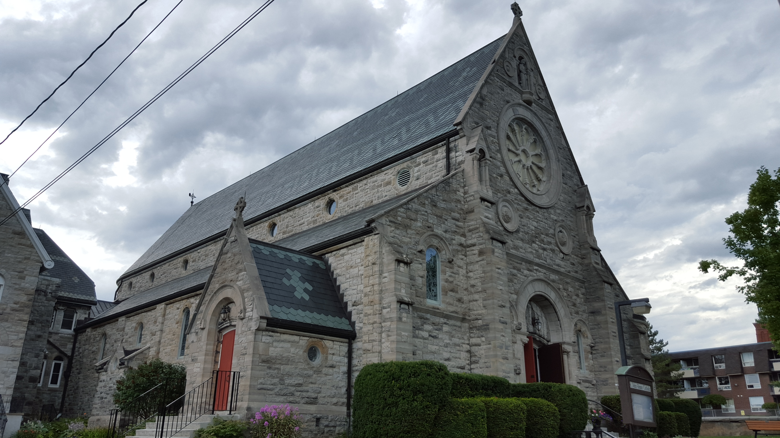
St. John The Evangelist Church, Gananoque, ON
St. John the Evangelist Chuch is over a century old. According to a news clipping scanned and found on the internet, the church has many treasures hidden below the paint and carpeting inside. The church, itself, is simply a marvel to see. I spent a few moments to reflect and pray and since it was a Sunday, I decided to also go through the readings and scripture.

Interior of St. John The Evangelist Church
Our time finished in the parish, the group headed off to find our next destination – the local micro brewery.

Gananoque Brewing Company
The gentlemen of our group each opted for a 12 oz of their choice (mine was a lager) whilst the ladies each went for a flight.
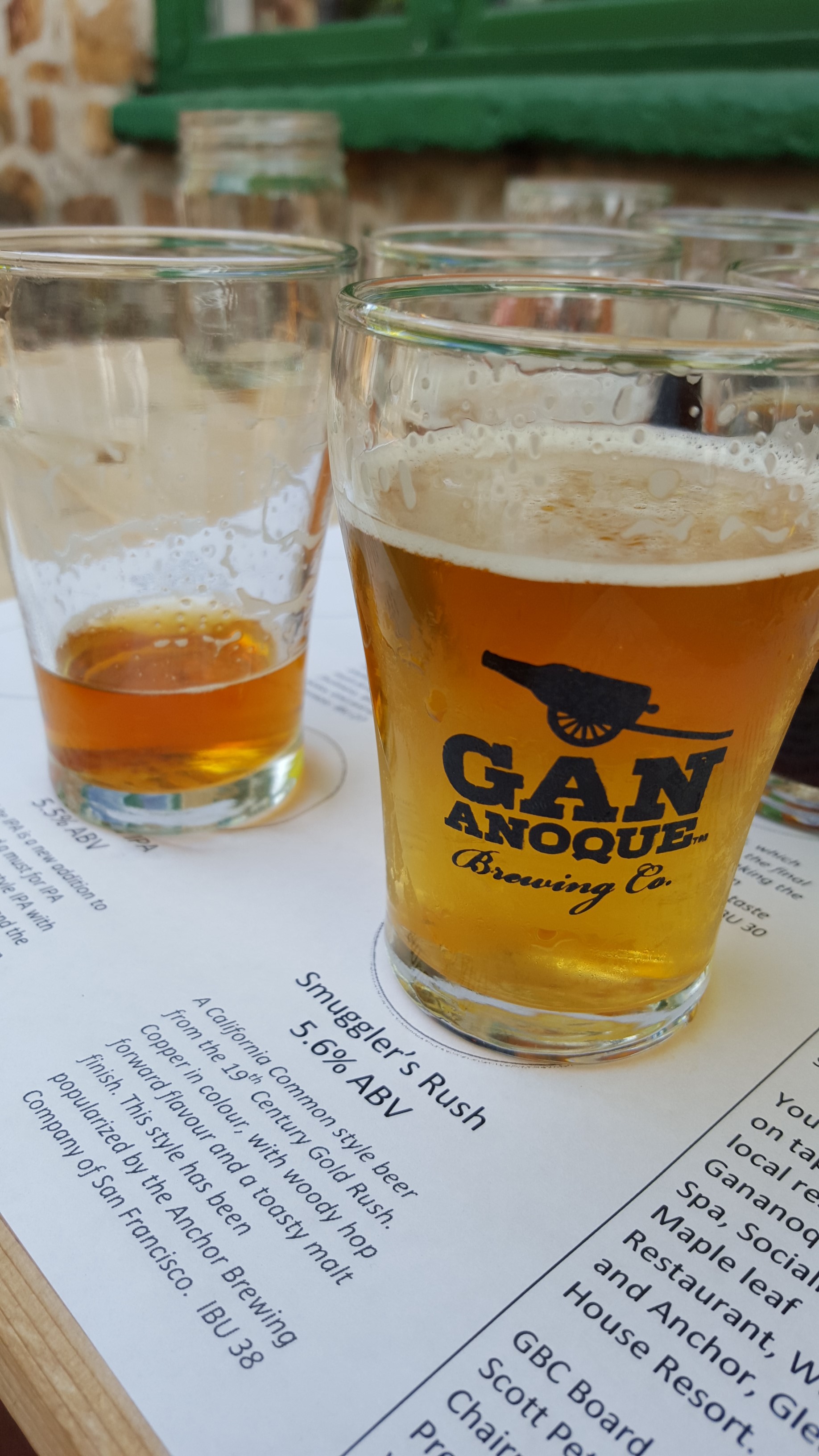
Trying different varieties…
This was followed by a walk to the lakeshore while checking out local sites.

Confederation Park, Gananoque, ON

Confederation Park, Gananoque, ON

1000 Island Tour Boats at the Gananoque waterfront. Water Street, Gananoque, ON.
After our brief stroll along the Gananoque waterfront, we split up. Girlfriend’s sister and brother-in-law made their way back to camp, while my girlfriend and I hopped back into Tricia and started to make our way home along the (now boring) Highway 401. We cruised with the windows open, wind rushing through the cabin and relaxing.
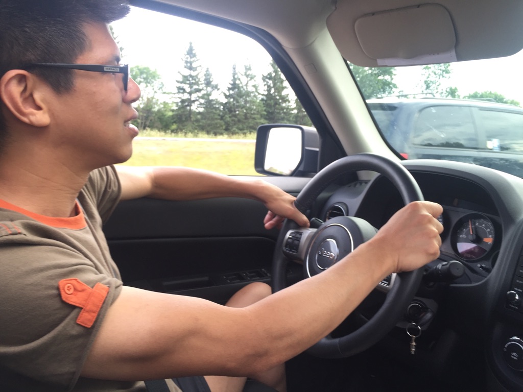
Cruising home on the 401. (Taken with my girlfriend’s Apple iPhone 6, not sure what settings…)
A loop of over 1000 km over 2 days and we are home! Tricia has had a good warm up for plenty more road trips. My girlfriend and I both had an awesome time – we’re also ready for the next trip!
Other side notes (for the camera and car geeks):
- Almost all snappy’s were jpegs taken with the Samsung Galaxy S6, unless otherwise noted.
- The jpegs came straight from their respective devices, unprocessed. Resizing occurred in WordPress only.
- Tricia sipped regular gas for the better part of the trip, mostly due to highway cruising around 100km/h and a very light gas pedal. Approx 7.9L/100KM or 30mpg was the average fuel consumption observed for the entire trip (better than the documented 8.7 mentioned in Jeep’s sales brochures!) YMMV.

One comment